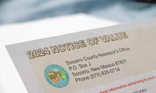
The public can now access maps and tax information online from the Socorro County website.
Gail Tripp, Socorro County Emergency Manager, announced the launch at the county meeting last week.
“We are officially online,” Tripp said.
Tripp told commissioners that the program wasn’t perfect or complete, but it is a work in progress. She said they need the public’s help to correct any discrepancies and will create a process for people to call the office and offer corrections. The maps, she said, were based on deed descriptions, not surveys, so property owners need to know that the lines aren’t exact.
At the meeting, she gave a demonstration on how the online database worked.
From the Socorro County website’s home page, users scroll down to assessor’s web button. This will give two options. The Socorro County parcel map will take you to the map lines where you can search properties and choose visual settings such as topographical or imagery.
The other option is the assessor’s website, this will take users to a page where they can enter EagleWeb. In this program, users can search by address, R number, or name. It will show the legal description, parcel, show owner’s name, the address, the GPS, longitude and latitude, parcel identification number, the R numbers, estimate tax amount, tax value and history, a photo of the house and a sketch of the house.
In an interview after the meeting, Tripp said she started working on the mapping in 2012 and at that time predicted it would be finished in five years. During that time, she developed a Geographical Information System Department to tackle the large project.
“It took longer than I thought,” said Tripp, “surveys weren’t required to be filed in the county until 1994, so there is a lot of data that wasn’t recorded.”
They also had to use old deeds, some written in Spanish, that needed to be translated and often used references to neighbors and churches to define their property lines.
“Some were written out that they were bounded on the west by the Griegos, and on the east by the Lujans, so there was no line, people occupied where they lived,” Tripp said.
She recalled that, in the beginning, with the help of a surveyor, he suggested starting with ten deeds around the courthouse. When she went to the clerk’s office and asked for deeds, expecting digital copies, she was surprised when they pointed her to the microfiche.
“So that’s how it all began, and we worked on it and worked on it. We have 41,000 parcels in the county total, and we have 3,000 Parcels left,” Tripp said.
This mapping will tie into the emergency 911 systems to help first responders.
In the meantime, Tripp said, “Please be patient with us, it’s developing and we are putting it together. Your input is valid and we need it, but it won’t all happen overnight.”
-
Jessica Carranza | Editorhttps://dchieftain.com/author/jcarranza/

-
Jessica Carranza | Editorhttps://dchieftain.com/author/jcarranza/

-
Jessica Carranza | Editorhttps://dchieftain.com/author/jcarranza/

-
Jessica Carranza | Editorhttps://dchieftain.com/author/jcarranza/